Catchment study and DANA diagnosis
l’Horta Sud · Spain · 2026
Technical data
- Type of work
- Hydrological study and flood-risk diagnosis
- Scale
- Catchment, with a detailed channel reach
- Studio’s role
- All of the work: hydrology, survey comparison, flood-level reconstruction, freeboard, simulation and mapping
- Channel analysed
- About 2.7 km · 5 sub-catchments
- Flood balance
- ~38,300 m³ eroded · ~47,700 m³ deposited
- Year
- 2026
- Status
- Diagnosis completed
Description
After the DANA floods of October 2024, the municipality needed to know what had happened in the watercourse and what a worse flood could do, on the basis of its own evidence that would stand up before the river basin authority. The available flood mapping had been prepared from a survey flown before the event, and the flood had changed the channel: it scoured the upper reach and silted up the lower one, precisely where drainage capacity was most needed.
The studio compared the topographic surveys before and after the flood, co-registered to an accuracy of about 8 cm, along some 2.7 km of channel. Section by section, the balance adds up to about 38,300 m³ eroded and about 47,700 m³ deposited, a net gain of about 9,500 m³: the flood stripped material from the upper reach and left it in the lower one. This map of the damage is the basis for sizing the clearance reach by reach.
Where no hydraulic model of the reach was available, the studio reconstructed the flood level from flood marks documented in the field and a level fill over the post-event terrain, matched to the mapped extent of the event. It is a conservative screening, not a substitute for a two-dimensional model. With that level it measured the bank freeboard at seven cross-sections: from 1 m above to 40 cm below, with the bank overtopped at one of them. Behind the bank, the urban ground lies between 3 and 5 m below the flood level.
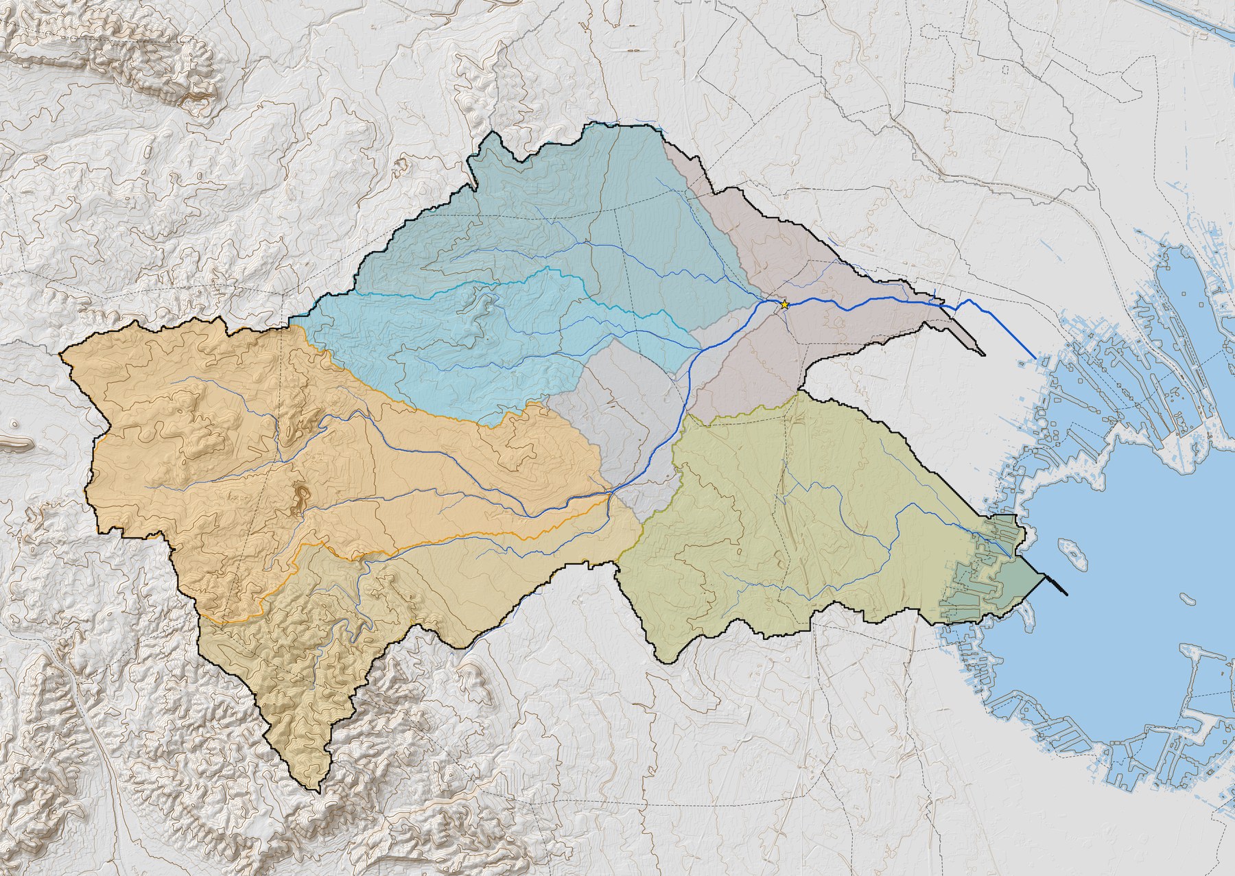
To understand what could have happened, the studio shifted the rainfall core across the catchment by 1, 5, 10 and 20 km. The worst case lies around ten kilometres from the actual one: the length of overtopped bank rises from about 250 m with a 1 km shift to about 1,060 m. Hence the criterion that governs the measures: design for the 500-year flood with freeboard, not for the observed event. The studio’s own hydrological study, across five sub-catchments using the rational method, provides a conservative envelope and is checked against that of the river basin authority, which remains the design reference.
Gallery
Sub-catchment and regional context maps, a diagnosis chart and an interpretive diagram prepared by the studio; the diagram is not to scale and has no orientation.